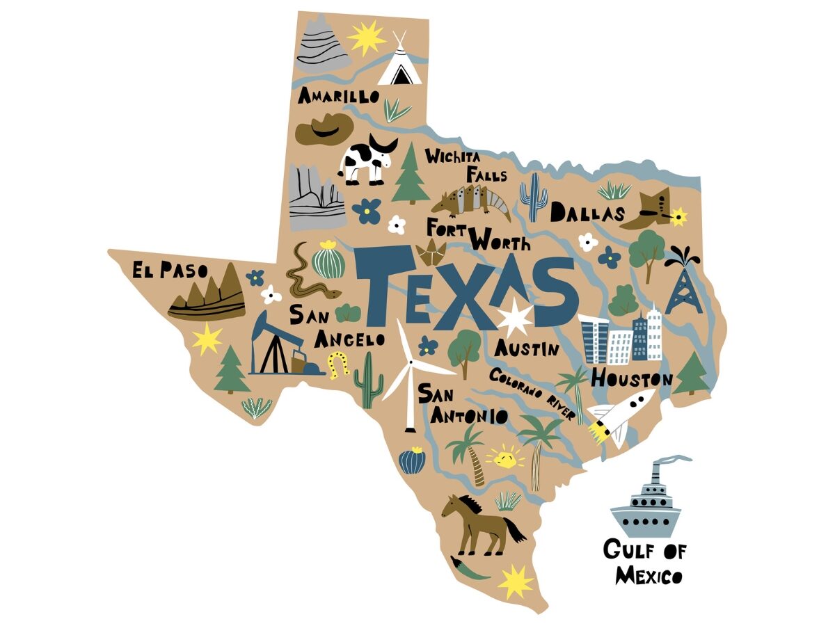
Texas is divided into seven regions: the Gulf Coast, the Central Texas Plains, the Hill Country, the South Texas Plains, the Rolling Plains, the High Plains, and the Trans-Pecos. Each region has distinct geographical features and cultural influences.
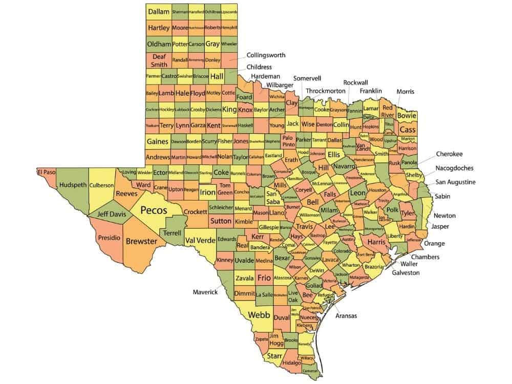
Texas makes up 7% of the entire land and water area of the US.. With 268,581 square miles and 254 counties, it’s one of the most diverse states in the nation. From the rugged mountains of Big Bend Country to the lush Piney Woods, every region offers a unique climate and vibrant attractions.
In total, Texas is divided into seven distinct regions: Big Bend Country, South Texas, Hill Country, Panhandle, Piney Woods, Gulf Coast, and Prairies and Lakes. Each area has its own charm and character, waiting to be explored.
The Seven Regions Of Texas
Many people are puzzled by the number of regions in Texas. Most assume that four parts make up this state, while others argue that there are seven parts of Texas. Both are, in fact, correct.
The four regions are referred to when talking about the geology of Texas. These four regions include the Interior Lowlands, Basin And Range, Great Planes, and the Gulf Coastal Planes.
Overview of Texas’s 7 Geographic Regions
Each region of Texas has distinctive features that set it apart from the others, creating a diverse tapestry of landscapes, cultures, and economic activities across the state.
| Region Name | Area Coverage | Primary Cities | Population (Est.) | Key Characteristics |
|---|---|---|---|---|
| East Texas (Piney Woods) | 35,000+ square miles | Tyler, Longview, Marshall, Nacogdoches | 1.7 million | Dense forests, lakes, oil industry |
| Gulf Coast | 24,000+ square miles | Houston, Galveston, Corpus Christi, Beaumont | 7.2 million | Coastal plains, major ports, petrochemicals |
| Hill Country | 25,000+ square miles | Austin, San Antonio, Fredericksburg, Kerrville | 4.8 million | Rolling hills, wineries, German heritage |
| North Texas | 45,000+ square miles | Dallas, Fort Worth, Plano, Arlington | 8.1 million | Urban metroplex, technology, finance |
| Panhandle Plains | 55,000+ square miles | Amarillo, Lubbock, Abilene, Wichita Falls | 1.2 million | Flat plains, agriculture, wind energy |
| South Texas | 85,000+ square miles | San Antonio, Laredo, McAllen, Brownsville | 2.8 million | Border culture, ranch land, citrus farming |
| West Texas | 50,000+ square miles | El Paso, Midland, Odessa, Big Bend | 1.1 million | Desert landscapes, oil production, mountains |
West Texas – Desert and Oil Country Profile
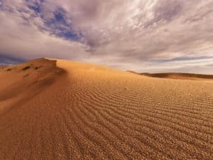
Texas Big Bend Country was named after Big Bend National Park. This part of Texas is located in the west and is filled with mountain peaks, wilderness, and captivating canyons. Big Bend is also home to the highest mountain in Texas, and some parts of these regions resemble the wild west, with rolling tumbleweeds and the endless desert.
A total of 9 cities form part of Big Bend Country; these include Alpine, Del Rio, Fort Davis, El Paso, Marathon, Marfa, Midland, Lajitas, and Presidio. Big Bend Country boasts a range of attractions, and many of them are centered around the natural beauty of this part of Texas. The most widely visited places in Big Bend include:
- Big Bend National Park
- Guadalupe National Park
- Davis Mountains
- Ross Maxwell scenic drive
- Santa Elena Canyon
- Stargazing at McDonald Observatory
- Art galleries
- Hot springs in the Rio Grande
- Historic sites
- Museums
- Black Jack’s crossing
West Texas represents the vast desert region of the state, characterized by mountain ranges, oil production, desert landscapes, and frontier heritage. This region embodies the classic image of Texas with its wide-open spaces and rugged terrain.
| Category | Details | Major Features | Economic Impact | Regional Identity |
|---|---|---|---|---|
| Geography | Chihuahuan Desert, mountain ranges, vast plains | Big Bend National Park, Guadalupe Mountains, Davis Mountains | 50,000+ square miles of diverse terrain | Most geographically diverse Texas region |
| Major Cities | El Paso (695K), Midland (146K), Odessa (123K), Alpine (6K) | Border metropolis, oil boom towns, college town | El Paso 6th largest Texas city | Smallest population density in state |
| Oil Industry | Permian Basin heart, shale oil production | World’s most productive oil field | $120+ billion annual oil production | Global energy significance |
| Desert Climate | Arid to semi-arid, extreme temperature variations | Less than 12 inches annual rainfall | Water scarcity challenges | Adaptation to harsh environment |
| Mountain Ranges | Guadalupe Peak (highest point in Texas), Davis Mountains | 8,751 feet elevation at Guadalupe Peak | Tourism and recreation economy | Unique Texas topography |
| Border Culture | 268-mile Mexico border, El Paso-Juárez metroplex | Largest binational metropolitan area | Cross-border trade $90+ billion | Bicultural identity strong |
| Military Presence | Fort Bliss, Holloman AFB nearby | Major Army installation | Military economic impact $12+ billion | National defense importance |
| Mining Heritage | Historic silver, copper, lead mining | Ghost towns, mining remnants | Tourism from mining history | Frontier settlement legacy |

South Texas – Border and Ranch Country
South Texas is a cultural hot spot and starts from the San Antonio River to the borders of the Rio Grande Valley. The largest and fastest-growing city in South Texas is San Antonio. South Texas is a historic part of Texas filled with stunning beaches, natural wonders, and enchanting wildlife. South texas is known for its Tex-Mex cuisine and its small-town feel.
There are 20 cities in South Texas, but the most popular are San Antonio, Dallas, Austin, and Houston. The people in South Texas are friendly and welcoming, and this inviting atmosphere draws people to visit South Texas.
The south of Texas has 367 miles of coastline, yielding an array of freshly caught seafood like shrimp, oysters, and snapper. South Texas is bustling with charm and attractions.
Some of the best activities in South Texas are:
- San Antonio River Walk
- Tour the Moody Mansion
- San Antonio Missions Heritage Site
- Gladys Porter Zoo
- Visit the NASA space center
- Visit the Cradle of Texas Independence
- Port Isabel Lighthouse
- Bird and wildlife watching
- Padre Island National Seashore
- Palo Alto Battlefield
- Bass Fishing in Falcon Lake
South Texas represents the cultural borderland between the United States and Mexico, characterized by ranchlands, border cities, and a rich Hispanic heritage.
| Category | Details | Major Features | Economic Impact | Cultural Significance |
|---|---|---|---|---|
| Geography | Rio Grande Valley, coastal plains, ranch lands | Rio Grande River, King Ranch, Gulf Coast | 2.8 million population | US-Mexico border region |
| Major Cities | San Antonio (partial), Laredo (261K), McAllen (143K), Brownsville (186K) | Border cities, trade centers | International trade $200+ billion | Hispanic majority population |
| Border Trade | USMCA (formerly NAFTA) commerce | Laredo busiest inland port | 40% of US-Mexico trade | Critical trade relationship |
| Agriculture | Citrus fruits, vegetables, cattle ranching | Winter Garden region, Rio Grande Valley | $1.2 billion agricultural output | Year-round growing season |
| Ranch Heritage | Historic cattle ranches, cowboy culture | King Ranch 825,000 acres | Ranching tradition continues | Iconic Texas identity |
| Energy Resources | Eagle Ford Shale, wind energy | Oil and gas production | Energy sector 25% regional economy | Economic transformation |
| Immigration | Major immigration corridor | Border Patrol, immigration courts | Economic and social impacts | National immigration policy focus |
| Maquiladoras | Cross-border manufacturing | Twin plant operations | Manufacturing employment significant | Economic integration with Mexico |
Hill Country – Central Texas Heartland
Texas Hill country falls in the central and south of Texas. Hill Country has many natural resources, culinary experiences, museums, and historical sites. If you love wine and shopping, Hill Country has some of the best wineries and exquisite boutique shops. Hill Country is also the second largest wine producer in the United States.
Hill Country has one of the fastest-growing economies in the US. Hill Country comprises many towns and cities, including San Marcos, Fredericksburg, Kerrville, and Blanco.
A rare species of gopher known as the Llano Pocket Gopher can be found in the Texas Hill Country. There are so many attractions in this part of Texas, some of the most exciting include:
- Hamilton Pool Nature Reserve
- Fall Creek Vineyards
- Tres Lunas resort
- Take a scenic drive down highway 16
- Kayak on the Medina River
- Enchanted Rock
- Garner State Park
- Natural Bridge Caverns
- Explore German Heritage in Fredericksburg
- Stonehenge II
- Hike to Gorman falls
The Hill Country represents the geographic and cultural heart of Texas, renowned for its rolling hills, vibrant wildflowers, rich German heritage, and thriving wine country.
| Category | Details | Major Features | Economic Impact | Cultural Identity |
|---|---|---|---|---|
| Geography | Rolling hills, spring-fed rivers, limestone terrain | Guadalupe River, Comal Springs, Enchanted Rock | Scenic beauty drives tourism | Geographic center of Texas |
| Major Cities | Austin (979K), San Antonio (1.5M), Fredericksburg (11K) | State capital, historic missions, German settlements | Combined metro GDP $200+ billion | Political and cultural capitals |
| German Heritage | 19th century German immigration legacy | Fredericksburg, New Braunfels, Comfort | Oktoberfest generates $17M annually | European cultural preservation |
| Wine Industry | 50+ wineries in region | Texas Wine Trail, vineyard tours | $1.88 billion state wine industry | Growing agricultural diversification |
| Wildflowers | Famous bluebonnet displays, Lady Bird Johnson legacy | Peak bloom March-May | Wildflower tourism $150M+ annually | State flower, environmental symbol |
| Music Scene | Austin “Live Music Capital of World” | SXSW, Austin City Limits Music Festival | Music industry $8.9 billion impact | Cultural export worldwide |
| Technology | Austin tech hub, “Silicon Hills” | Major tech companies, startups | Technology sector $41 billion output | Innovation economy leader |
| Springs and Rivers | Natural springs, clear rivers, swimming holes | Barton Springs, San Marcos River | Recreation economy significant | Water resources precious |

Panhandle Plains – High Plains Agriculture
The Texas Panhandle is located in the northernmost part of Texas. The Panhandle has 26 counties and is 25,610 square miles. This part of Texas is abundant in art and natural beauty but is also susceptible to scorching temperatures.
The Panhandle is flat and dry and can occasionally experience dust storms. The Panhandle is also filled with music history and is celebrated with numerous music festivals.
The biggest cities in the Panhandle are Abilene, Wichita Falls, San Angelo, Amarillo, and Lubbock. The Texas panhandle is home to rare animals, including the Black-footed ferret, Texas Kangaroo, and the Palo Duro mouse.
There is so much to explore in the Texas panhandle and lots of activities for those who love adventure. Some of the most thrilling attractions in the Panhandle are:
- Cadillac Ranch
- Route 66
- Wonderland Amusement Park
- Bob Wills Museum
- Palo Duro Canyon State Park
- Hike the tunnel trail
- Panhandle plains historical museum
- Amarillo Livestock Auction
- American Windmill Museum
- Big Texan Steak Ranch in Amarillo
- Buddy Holly Center
The Panhandle Plains region covers the northern portion of Texas, characterized by flat terrain, extensive agriculture, and significant wind energy development.
| Category | Details | Major Features | Economic Impact | Agricultural Importance |
|---|---|---|---|---|
| Geography | High Plains, flat terrain, semi-arid climate | Llano Estacado, Canadian River, Palo Duro Canyon | Vast agricultural lands | 2nd largest Texas region |
| Major Cities | Amarillo (201K), Lubbock (258K), Abilene (125K) | Regional agricultural centers | Agricultural processing hubs | Rural population centers |
| Agriculture | Cattle ranching, cotton, grain sorghum, corn | Leading cattle feeding region | $4.8 billion agricultural output | Feeds much of America |
| Wind Energy | Massive wind farm development | Nation’s leading wind energy region | 28% of Texas electricity generation | Renewable energy leadership |
| Oil and Gas | Permian Basin extension, natural gas | Significant energy production | Oil industry employment 8% regional | Traditional energy backbone |
| Climate | Semi-arid, temperature extremes, low rainfall | 15-20 inches annual precipitation | Irrigation agriculture dependent | Weather challenges constant |
| Transportation | I-40, I-27, rail lines, regional airports | Cross-country transportation corridor | Agricultural product shipping | Logistics infrastructure critical |
| Education | Texas Tech University, West Texas A&M | Agricultural research, rural education | University economic impact $2.4B | Agricultural research leadership |
Piney Woods
The Piney Woods is also called East Texas and gets its name from all the piney woods in this region. The Piney Woods is also known for the great oil boom, lakes, unique ecosystems, and wildlife. Some of the animals you may see in the Piney Woods are cottonmouth snakes, opossums, and rabbits.
The Piney woods also has low-lying wetlands and swamps. Moderate rainfall in the Piney Woods ensures the forests stay evergreen all year round. The Piney woods are also a great place to grow vegetables and flowers.
This part of Texas has eight cities, including Gladewater, Kilgore, Longview, Huntsville, Lufkin, Nacogdoches, Texarkana, and Tyler.
Most attractions in the Piney Woods are outdoor attractions and include hiking, biking, and watersports and a few other attractions like:
- Fishing at Lake Fork
- Visit a national forest
- Caldwell Zoo
- Zipline in Nacogdoches
- Swamp tour
- Mission Tejas State Park
- Longview Museum Of Fine Arts
- 8th Air Force museum
- Train Ride between Palestine and rusk
- Haunted tour of Jefferson Hotel
- Harrold’s Model Train Museum
East Texas (Piney Woods) – Detailed Regional Profile
East Texas represents the forested region of the state, characterized by dense pine forests, numerous lakes, and a culture deeply rooted in Southern traditions and the oil industry.
| Category | Details | Major Features | Economic Impact | Cultural Significance |
|---|---|---|---|---|
| Geography | Rolling hills, dense forests, river valleys | Caddo Lake, Sam Rayburn Reservoir, Angelina National Forest | Timber industry $2.1 billion annually | Deep South cultural connections |
| Climate | Humid subtropical, high rainfall | 45+ inches annual precipitation | Agriculture supported by moisture | Distinct seasons, mild winters |
| Major Cities | Tyler (109,000), Longview (81,000), Marshall (23,000) | Rose capital, oil refining, historic courthouse squares | Regional economic centers | Small town heritage preserved |
| Natural Resources | Timber, oil, natural gas, clay | Largest forest region in Texas | Energy sector employment 15% of workforce | Conservation vs. development balance |
| Agriculture | Beef cattle, poultry, timber, roses | Tyler rose industry nationally significant | $890 million agricultural output | Family farm traditions strong |
| Tourism | State parks, lakes, historic sites | Caddo Lake State Park, Texas State Railroad | $1.2 billion visitor spending | Ecotourism and heritage tourism |
| Transportation | I-20, US 59, regional airports | Major highways connect to Dallas/Houston | Freight corridors important | Rural transportation challenges |
| Education | Stephen F. Austin State University, UT Tyler | Regional university system | Higher education economic driver | Educational attainment below state average |
Gulf Coast
The Gulf Coast part of Texas has an array of quaint coastal towns, seaside activities, and never-ending dunes. The Gulf Coast offers the perfect blend of art, culture, and vibrant city life. The best coastal cities in this region include Corpus Christi, Galveston, and Rockport.
The Gulf Coast’s humid subtropical climate makes it an ideal destination for a summer vacation. The Gulf Coast is also a central hub for economic activity, especially in the fishing industry. This part of Texas is vulnerable to floods and hurricanes, but these natural weather conditions are restricted to the inland parts of the Gulf Coast.
The Gulf Coast is also commonly known as America’s third coast. The largest town in the southern part of the Gulf Coast is Corpus Christi, and the biggest city on the Gulf Coast is Houston.
The Gulf Coast is home to fishing piers, restaurants, live theatres, and water parks. Some of the most exciting attractions on the Gulf Coast are:
- Dolphin watching
- Pleasure Pier Amusement Park
- Horseback riding in Corpus Christi
- Space Center Houston
- Texas State Aquarium
- Museum of Fine Arts Houston
- Red and Black Dragon Pirate Cruise
- Surfing
- Moody gardens
- Battleship Texas
- Deep Sea Fishing
Gulf Coast – Maritime Texas Profile
The Gulf Coast region encompasses Texas’s entire coastline along the Gulf of Mexico, featuring major ports, petrochemical industries, and beach communities.
| Category | Details | Major Features | Economic Impact | Strategic Importance |
|---|---|---|---|---|
| Geography | 367 miles of coastline, barrier islands, coastal plains | Galveston Island, Padre Island, Houston Ship Channel | Port of Houston 2nd busiest in US | Critical international trade gateway |
| Major Cities | Houston (2.3M), Corpus Christi (327K), Galveston (50K) | Energy capital of world, major port cities | $678 billion regional GDP | Global economic connections |
| Energy Industry | Petroleum refining, petrochemicals, renewable energy | 27 refineries, largest in US | 40% of US refining capacity | National energy security role |
| Ports and Shipping | Port of Houston, Corpus Christi, Galveston, Beaumont | Container shipping, bulk commodities | $800+ billion cargo value annually | International commerce hub |
| Climate | Hot, humid summers, mild winters, hurricane risk | Hurricane season June-November | Weather-related economic impacts | Coastal resilience planning |
| Tourism | Beaches, fishing, space center, historic districts | NASA Johnson Space Center, beach tourism | $8.2 billion visitor spending | Space exploration heritage |
| Environment | Coastal marshes, wildlife refuges, fisheries | Texas Gulf Coast bird migration route | Commercial fishing $500M annually | Environmental protection priorities |
| Infrastructure | Ship channels, refineries, pipelines | Extensive petrochemical infrastructure | Critical energy infrastructure | Strategic national asset |
North Texas – Urban Metroplex Region – Prairies And Lakes
The Prairies and Lakes region of Texas is located in central and north-central Texas. This part of Texas lies between the Panhandle and the Piney Woods. The prairies and lakes in the second-largest region in Texas boast numerous agricultural activities. The north-central section of the prairies and lakes is home to many horse farms and horse enthusiasts.
This region was also home to dinosaurs, and to date, 21 dinosaur fossils have been found in this region. There are 50 counties in the Prairies and Lakes part of Texas. Some of these counties include Austin, Rockwell, Dallas, Franklin, Hamilton, and Montague. Dallas is the largest metropolitan area in this region, with nearly 7 million residents.
Popular activities in this region include camping, RV’ing, and water activities. The Prairies and Lakes region has many parks, including Bonham, Cedar Hill, and Palmetto State Park. This part of Texas is home to several rare animals, including the Houston toad, the Golden-cheeked Warbler, and the Black-capped Vireo. The Prairies and Lakes have a wide variety of vegetation, including Pecan trees, Bur Oak, Buttonbush, and Black Walnut.
When visiting the prairies and lakes regions, you can expect to find a few unique attractions like:
- Dallas Arboretum and Botanical Garden
- BSR Cable Park and Surf Resort
- Washington-on-the-Brazos State Historic Site.
- Dinosaur Valley State Park, Glen Rose
- Cedar Hill State Park
- Carleen Bright Arboretum
- Mandalay Canals
- Fort Worth Water Gardens
- Line dancing at Billy Bob’s in Fort Worth
- Ride the giant roller coaster at Six Flags Over Texas
North Texas encompasses the Dallas-Fort Worth Metroplex, the largest urban area in Texas and the fourth-largest metropolitan area in the United States.
| Category | Details | Major Features | Economic Impact | National Significance |
|---|---|---|---|---|
| Major Cities | Dallas (1.3M), Fort Worth (918K), Plano (286K), Arlington (398K) | Twin cities metroplex model | Combined GDP $620+ billion | 4th largest US metro economy |
| Corporate Headquarters | Fortune 500 companies concentration | 24 Fortune 500 headquarters | Corporate sector dominance | Business leadership center |
| Transportation Hub | DFW Airport, Love Field, major highways | DFW 2nd busiest airport globally | Aviation industry $37 billion impact | Central US location advantage |
| Financial Services | Banking, insurance, investment management | Regional Federal Reserve Bank | Financial sector $89 billion output | Southwestern financial capital |
| Technology Sector | Telecom Corridor, data centers, startups | Major tech company presence | Technology employment 400K+ jobs | Innovation ecosystem |
| Education | UT Dallas, TCU, SMU, UNT system | Research universities, community colleges | Higher education $12 billion impact | Skilled workforce development |
| Sports and Entertainment | Professional sports teams, entertainment venues | Cowboys, Rangers, Mavericks, Stars, FC Dallas | Sports economy $3.2 billion annually | National sports market |
| Defense Industry | Aerospace, defense contractors | Lockheed Martin, Bell Helicopter | Defense contracts $25+ billion | National security contribution |
Regional Comparison – Climate and Geography
Understanding the dramatic differences in climate and geography across Texas’s seven regions helps explain the state’s incredible diversity and regional characteristics.
| Region | Climate Type | Annual Rainfall | Temperature Range | Elevation Range | Dominant Terrain |
|---|---|---|---|---|---|
| East Texas | Humid subtropical | 40-50+ inches | 35°F – 95°F | 200-700 feet | Dense forests, rolling hills |
| Gulf Coast | Humid subtropical/tropical | 30-55 inches | 45°F – 95°F | Sea level – 200 feet | Coastal plains, marshes |
| Hill Country | Humid subtropical | 25-35 inches | 30°F – 100°F | 500-2,300 feet | Rolling hills, limestone terrain |
| North Texas | Humid subtropical/continental | 25-40 inches | 25°F – 105°F | 400-1,500 feet | Prairie, urban development |
| Panhandle Plains | Semi-arid continental | 15-25 inches | 10°F – 100°F | 3,000-4,000+ feet | High plains, flat terrain |
| South Texas | Semi-arid to subtropical | 15-30 inches | 40°F – 105°F | Sea level – 1,000 feet | Coastal plains, brush country |
| West Texas | Arid to semi-arid | 8-20 inches | 20°F – 110°F | 1,000-8,751 feet | Desert, mountains, basins |
References:
- Texas regions: tpwd.texas.gov
- A quick guide to parts of Texas: matadornetwork.com
- Texas travel guide: roughguides.com

Christian Linden is a seasoned writer and contributor at Texas View, local Texas resident, travel enthusiast.and author of the Home Energy Playbook. He specializes in topics that resonate with the Texan community. With over a decade of experience in journalism, Christian brings a wealth of knowledge in local politics, culture, and lifestyle. When he's not writing, Christian enjoys spending weekends traveling across Texas with his family, exploring everything from bustling cities to serene landscapes.