Share the post "From Border to Border: Unveiling Texas’ Most Epic Stretches"
The longest distance in Texas is a natural response to the saying, “Everything is bigger in Texas,” and we’re here to answer it!
The longest distance in Texas, a straight line from its northernmost part to its southernmost point, is 801 miles. This distance requires a drive of approximately 12 hours at a speed of 70 miles per hour without calculating any stops for rest or filling the gas tank.
Are you intrigued to learn more about Texas’s geographical features and how big everything here is? Read on for some interesting facts!
The Longest Distance in Texas
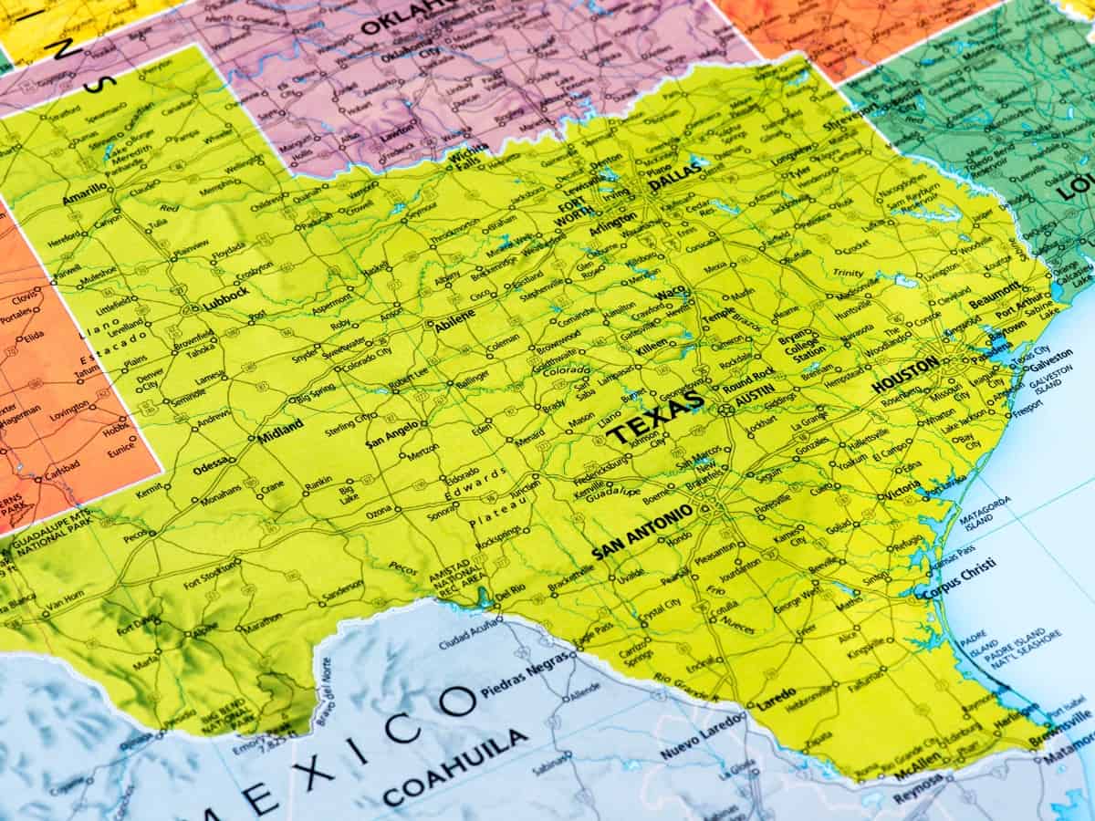
As previously pointed out, the longest distance in Texas in a north-to-south direction is 801 miles. More specifically, the journey begins in the Panhandle in the far northwest and ends below Brownsville on the southern tip of the state.
If you’re wondering about the largest distance in an east-to-west direction, that’s around 773 miles, which is also unbelievably huge!
In this case, you’ll want to go from the eastward bend of the Sabine River in Newton County to the absolute west of the state. That’s precisely above El Paso on the Rio Grande. The trip will likely take around 11 hours at 70 miles per hour nonstop.
Table of Distances to Each Main City in Texas
Here is a simplified table that covers distances between some of the main cities in Texas. This table should give you a general idea of the distances involved when traveling within Texas.
| From / To | Houston | Dallas | San Antonio | Austin | Fort Worth | El Paso | Corpus Christi | Amarillo |
|---|---|---|---|---|---|---|---|---|
| Houston | – | 240 | 200 | 165 | 260 | 745 | 210 | 600 |
| Dallas | 240 | – | 275 | 195 | 30 | 635 | 405 | 365 |
| San Antonio | 200 | 275 | – | 80 | 275 | 550 | 145 | 500 |
| Austin | 165 | 195 | 80 | – | 200 | 580 | 215 | 450 |
| Fort Worth | 260 | 30 | 275 | 200 | – | 615 | 415 | 340 |
| El Paso | 745 | 635 | 550 | 580 | 615 | – | 800 | 420 |
| Corpus Christi | 210 | 405 | 145 | 215 | 415 | 800 | – | 660 |
| Amarillo | 600 | 365 | 500 | 450 | 340 | 420 | 660 | – |
Notes:
- These distances are approximate and can vary depending on the specific route taken.
- Distances are in miles and represent the shortest path between city centers.
- For specific routes, it’s recommended to use a GPS or an online mapping service like Google Maps for the most accurate and current information.
This table includes some of the most traveled routes in Texas but is by no means exhaustive, given the state’s size and number of cities. Using a mapping service would be the best approach for more detailed information, including distances to other cities or specific locations within these cities.
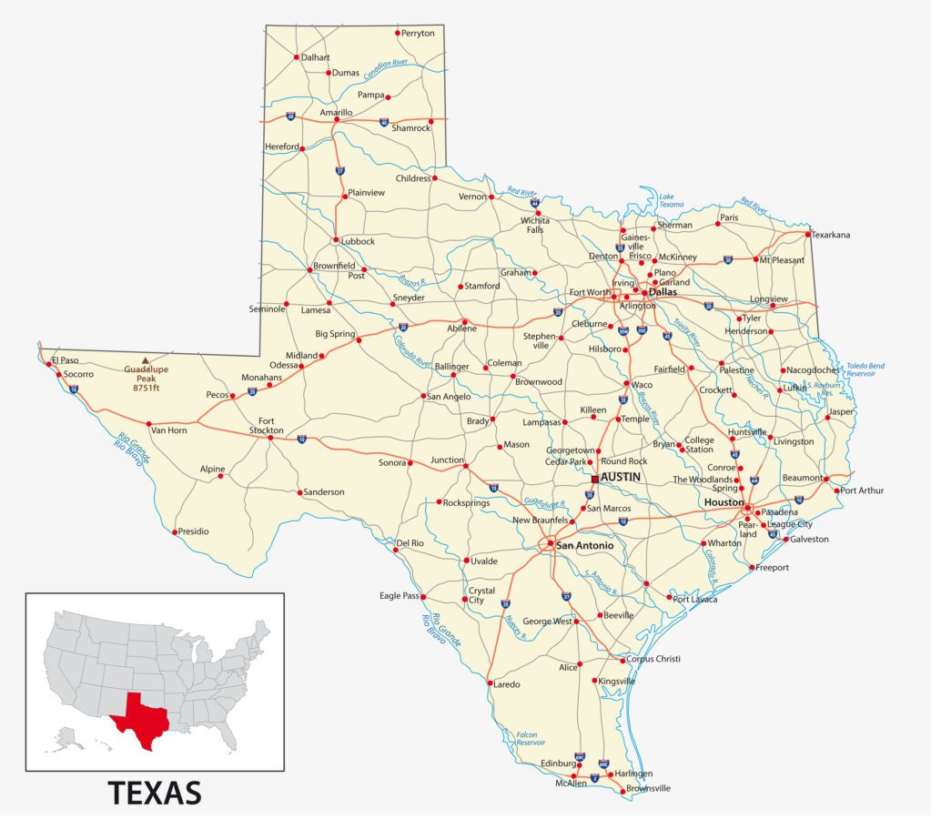
Furthest Distances in Texas from North To South + East to West
Distances in Texas from north to south and east to west is quite helpful to understand the vastness of the state. Here is a concise breakdown:
North-to-South Distance in Texas
- From the northernmost point (Perryton, in Ochiltree County) to the southernmost point (Brownsville, in Cameron County)
- Approximate Distance: About 801 miles (1,289 kilometers).
East-to-West Distance in Texas
- From the easternmost point (Orange, in Orange County) to the westernmost point (Anthony, in El Paso County)
- Approximate Distance: Around 860 miles (1,384 kilometers).
These distances provide a perspective on Texas’s geographical expanse. Remember, these are straight-line distances; actual travel distances may vary depending on the route taken.
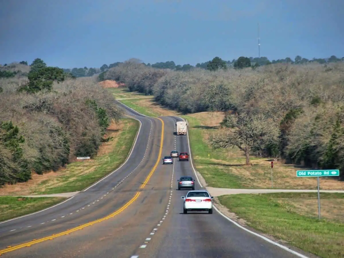
Additionally, Texas’s diverse geography means that the experience of traveling through these distances can vary greatly, from the plains in the north to the coastal areas in the south, and from the forests in the east to the deserts in the west.
The Area of Texas
Of course, after looking at the vast distances from the state’s east to west and north to south, it’s safe to assume that the area of Texas is too large to comprehend. That’s true; Texas is a whopping 268,597 square miles!
This could’ve landed Texas a spot as the biggest state in the United States if it weren’t for Alaska, which extends over 570,380 square miles. Fun fact: Alaska can fit the following three largest states onto its land, namely Texas, California, and Montana!
The Boundary Lines of Texas
Now, back to more mind-blowing geographical information about the Lone Star State. This time, we’ll take a closer look at the boundary lines of Texas and how they all add up to make up its circumference.
Here are the measurements of Texas’s boundaries if you count each bend in every river, even the small ones, the tidewater coastline, large river bends, and land borders.
| Boundary | Length |
| Northern Panhandle Line | 176 miles |
| Western Panhandle Line | 310.2 miles |
| Eastern Panhandle Line | 133.6 miles |
| Along 32nd Parallel | 209 miles |
| Rio Grande | 1,254 miles |
| Coastline | 624 miles |
| Sabine River (Lake and Pass) | 292 miles |
| Red River | 726 miles |
| Sabine River to Red River | 106.5 miles |
| Total | 3,822 miles |
How Long Will It Take to Drive the Length of Texas?
Surely, you know by now that hitting the 801-mile road trip won’t be a piece of cake. Still, if you’re an adventurous soul with wanderlust, driving the length of Texas can be a challenge worth taking.
To answer your question, it’ll require 12 to 14 hours of driving from Texas’s northernmost part to its southernmost point. This duration varies depending on the number and lengths of stops you’ll take to grab some snacks, stretch your legs, fill the tank, or go to the bathroom.
However, you should expect to take even longer to drive 801 miles because you never know when you’ll face traffic. We’d say 15 to 16 hours should do the trick!
Tips to Keep in Mind When Driving the Longest Distance in Texas
If going from Texas’s uppermost region to its lowermost point is on your bucket list, it’s time to make your dream come true. But, before you get behind the driving wheel, you’ll need to remember a few things first.
Here are some general guidelines to follow in preparation for your Texas-based adventure:
- Take a good look at the road map to plan your stops so that you don’t end up with an empty tank in the middle of nowhere
- Always head over to the nearest gas station when the tank is half full
- Get ready for higher speed limits on the road (ranging from 70 to 75 miles per hour)
- Ideally, try to time your crossing through major cities like Austin, Dallas, and Houston so you don’t find yourself in the middle of rush hour.
- Stick to the fast lane as much as possible to save time

Long Distance Road Trips in Texas
With its vast expanse and diverse landscapes, Texas offers some of the most scenic and exciting road trips in the United States. Here are a few notable road trips in Texas, each highlighting key landmarks and attractions along the way:
1. Houston to Big Bend National Park
- Total Distance: Approximately 600 miles.
- Estimated Driving Time: Around 10 hours.
- Houston Space Center
- San Antonio
- Fredericksburg
- Big Bend National Park
2. Dallas to El Paso
- Total Distance: Roughly 635 miles.
- Estimated Driving Time: About 9-10 hours.
- Fort Worth Stockyards
- Abilene
- Midland-Odessa
- El Paso
3. Austin to the Gulf Coast
- Total Distance: Around 230 miles.
- Estimated Driving Time: Approximately 4-5 hours.
- San Marcos
- San Antonio
- Corpus Christi
- Padre Island National Seashore
4. The Texas Hill Country Loop (Starting and Ending in Austin)
- Total Distance: Approximately 250 miles.
- Estimated Driving Time: About 5 hours.
- Fredericksburg
- Enchanted Rock State Natural Area
- Luckenbach
- Austin
5. Panhandle-Plains (Amarillo to Lubbock)
- Total Distance: Nearly 120 miles.
- Estimated Driving Time: Around 2 hours.
- Palo Duro Canyon State Park
- Cadillac Ranch
- Lubbock
6. East Texas Piney Woods (Houston to Tyler)
- Total Distance: About 200 miles.
- Estimated Driving Time: Approximately 3-4 hours.
- Sam Houston National Forest
- Nacogdoches
- Tyler
These distances and times are estimates and can vary based on the specific starting and ending points within the cities, traffic conditions, and stops. These routes offer a blend of scenic beauty, cultural experiences, and historical insight, making them perfect for exploring the diverse landscape of Texas.
Distance in Texas FAQ
What two cities make up the longest driving distance in Texas?
El Paso and Texarkana are the two cities that mark the beginning and end of the longest driving distance in Texas.
El Paso is located on the lowermost side of the state toward the west. On the other hand, Texarkana lies in the uppermost part of Texas in the east.
What landmarks to watch for when driving the longest distance in Texas?
Despite being a challenging trip, the road from El Paso to Texarkana lacks exciting landmarks and attractions to entertain you. You’ll come across everything from awe-inspiring natural landscapes to busy urban areas.
If you’re not in a hurry to finish your 14-hour drive and have more time to do some sightseeing, we have some suggestions for you.
The following list includes a few things you can do at the sites and places you’ll pass by on your journey. Consider trying each of them to add more fun to your trip!
– Explore the bustling city life of major cities such as Houston, Dallas, or Austin
– Take a relaxing walk or have a picnic at Big Bend National Park
– Go to the famous Magnolia Market in Waco and enjoy walking amidst all the various shops
Share the post "From Border to Border: Unveiling Texas’ Most Epic Stretches"
Christian Linden is a seasoned writer and contributor at Texas View, specializing in topics that resonate with the Texan community. With over a decade of experience in journalism, Christian brings a wealth of knowledge in local politics, culture, and lifestyle. He holds a Bachelor's degree in Communications from the University of Texas. When he's not writing, Christian enjoys spending weekends traveling across Texas with his family, exploring everything from bustling cities to serene landscapes.


