Share the post "Canadian River Texas (Path and Importance)"
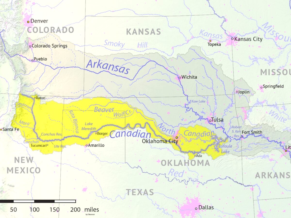
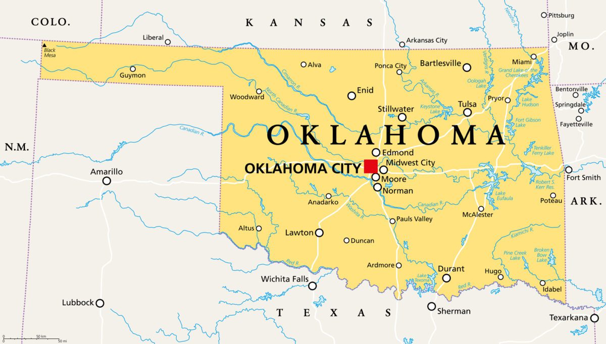
It might be called the Canadian River, but this major tributary flows from the Rocky Mountains in Colorado to join the Arkansas River in Oklahoma. It weaves its way through the Texas Panhandle, in the northern part of Texas near Amarillo. The Canadian River Basin was once part of Indian Territory.
A major tributary of the Arkansas River, the Canadian River starts in Colorado and winds through New Mexico, Texas, and Oklahoma. It once formed the southern border of the newly-created United States and was first explored by Europeans in 1601. It’s vital for wetlands in the dry plains regions.
The Canadian River In Texas
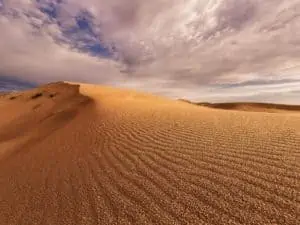
The Canadian River is roughly 1,026 miles long. It begins in the Sangre de Cristo Mountains, close to the border of Colorado and New Mexico. About 190 miles of the Canadian River passes through the uppermost part of Texas, crossing through the Panhandle.
- It creates a canyon that separates the Llano Estacado plains from the High Plains in the north
- The river enters Texas in Oldham County and crosses six Texas Counties
- It leaves Texas in Hemphill county, where it enters Oklahoma
- The Canadian River is the largest tributary river of the Arkansas River
- It has a drainage area of approximately 47,700 miles
The Canadian River flows from the Rocky Mountains to the south and southeast until it joins the Arkansas River in Colorado. While most of the river is slow-moving, it can carry much water after heavy rains.
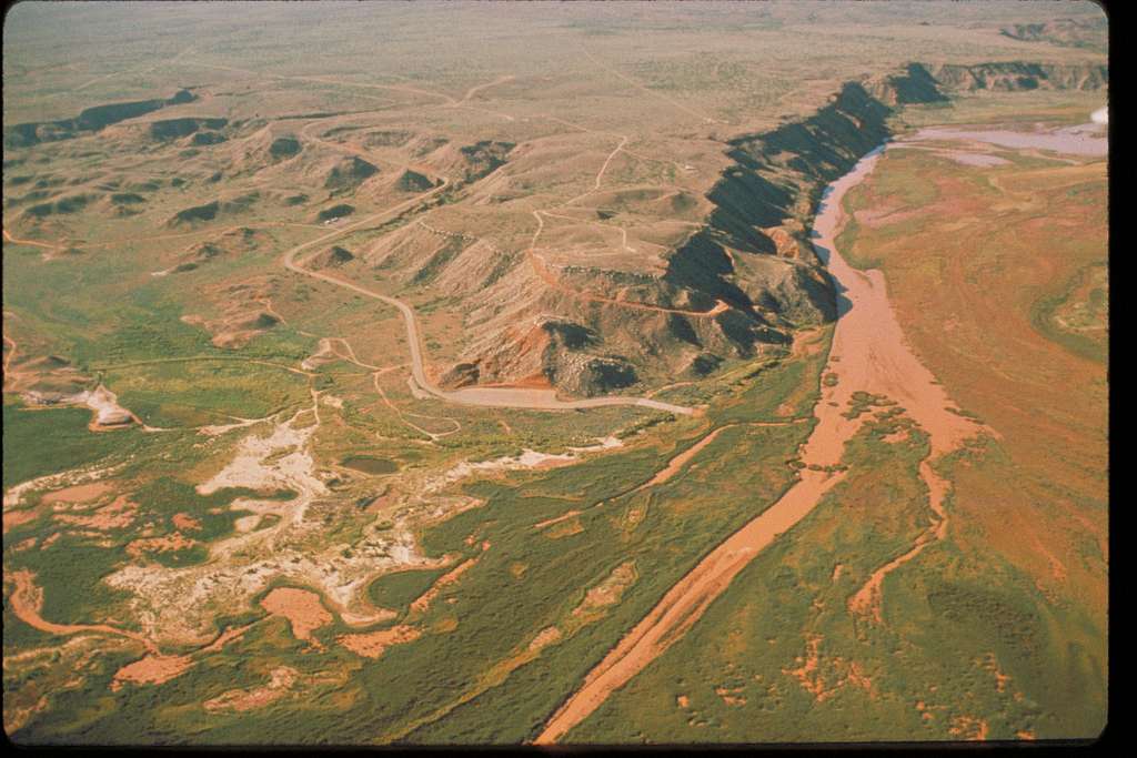
In Texas, it carves a canyon that separates the mesa of Llano Estacodo from the rest of the Great Plains.
Texas Counties Of The Canadian River
The Canadian River passes through six Texas counties as it courses through the Texas Panhandle. On the eastern side, the river enters from New Mexico, about midway through the border of Oldham County.
From there, it moves northwest and west until it’s dammed to form Lake Meredith at Sanford. With a northwesterly course, it exits Texas on the western border of Hemphill County.
The Canadian River passes through six counties: Oldham, Potter, Moore, Hutchinson, Roberts, and Hemphill. Most of the Canadian River in Texas passes through a gorge that crosses the Panhandle.
The 500-800 foot canyon separates the High Plains and the Llano Estacado plateaus in New Mexico and northeast Texas.
History Of The Canadian River Texas
The Spanish governor of New Mexico, Juan de Onate, explored the river from its origin in 1601 and got as far as the western plains of Oklahoma. It’s believed he called the river the Magdalena. After that, European traders and hunters began working in the area. Later expeditions explored the river mouth.
In 1740, the French-Canadian brothers Pierre and Paul Mallet followed the river’s entire course. By 1818, the Canadian River became the southern border of the new United Stations nation after the Quapaw tribe surrendered their lands north of the river.
Slowly, trading posts were established all along the river. As the States expanded and Indian Territory was taken, the border moved further south.
The Tribes of the Canadian River
The Canadian River was once the boundary between the lands of the Creek-Seminole and the Choctaw and Chickasaw. To the north lay the Creek-Seminole lands, while the Choctaw claimed the southern lands. Other Native American people who lived along the Canadian River include the Quapaw and the Osage.
In 1820, the Treaty of Doak’s Stand made the Canadian River become the northern boundary of the nation of the Choctaw. The treaty was also known as Treaty with the Choctaw, and in it, the Choctaw agreed to give up half their remaining land to the United States.
The Choctaws were threatened with destruction if they did not cede the land west of the Mississippi.
Geology and Reservoirs of the Canadian River Basin Texas
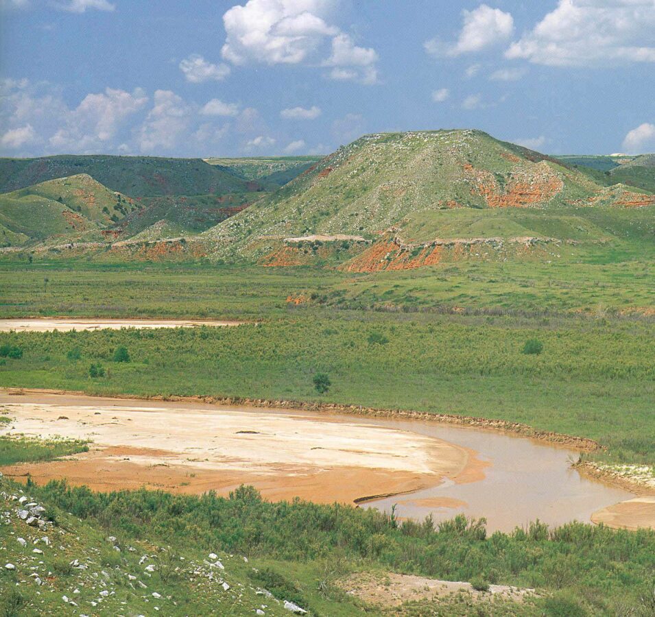
The deep gorge of the Canadian River in Texas makes crossing the river challenging. It was difficult for early settlers to build bridges as the valley river was cut into soft red sandstone. Other geological features along the river include gypsum, flint, dolomite, and sections of fossilized wood.
The river has eroded a series of gorges and canyons along the flatter plains of the Panhandle. In 1962-65, the river was dammed north of Amarillo at Sanford to create Lake Meredith. While it once served as a border, today, the Canadian River in Texas is important for conservation and water reservoirs.
The Reservoir of Lake Meredith
The Sanford Dam was built across the Canadian River about eight miles west of Borger, Texas. The resulting reservoir is Lake Meredith, which covers an area of 30,466 acres at maximum capacity.
Operated by the Canadian River Municipal Water Authority, it supplies industrial and municipal water to the surrounding areas, notably Amarillo and Lubbock.
However, ongoing droughts have continued to drop the water level, and water supplies now mostly come from wells in Roberts County.
Lake Meredith still provides conservation areas and recreation for boaters, anglers, camping, and water sports. The lake is slowly recovering from the drought of 2011-2013.
Palo Duro Reservoir
The Canadian River Valley winds its way across the Panhandle. It includes several other tributary rivers and creeks, which help supply water to the dry plains. The Palo Duro Creek is a tributary of the Canadian River. In 1985, construction began on a dam and reservoir in Hansford County.
The severe droughts have left the reservoirs for Texas struggling, and the current reservoir storage for Palo Duro is only 0.3% full.
Rita Blanca Lake
The Rita Blanca Creek is another Canadian River tributary that was dammed, initially for flood control purposes. It was later adapted for recreational use in 1938. The City of Dalhart has a 99-year lease allowing them to operate the lake as a recreational facility, valid from 1951.
The lake is also a conservation area for fish and birdlife and has a surface area of 524 acres.
Sites Along The Canadian River Texas
Several historical sites and conservation areas spread along the Canadian River as it winds through the north Panhandle region. Archeological remains have been found along the Texan parts of the Canadian River, notably of the Pueblo Indian culture.
The Canadian Valley area in Texas is today principally used for ranching area.
- Canadian River Historic Wagon Bridge
- Lake Meredith Natural Recreation Area
- Alibates Flint Quarries National Monument
- Crossbar Overlook Reserve
- Gene Howe Wildlife Management Area
Canadian River Historic Wagon Bridge
The city of Canadian has a long history of local culture and arts, and they have preserved this with the Canadian Cultural District, which includes historical venues, exhibitions, tours, and museums.
The Canadian River Walking Bridge is a metal truss bridge that was the longest of its type in the state when it was built. It has been reopened as part of a scenic hiking and biking trail.
Lake Meredith Natural Recreation Area
The dry grassy prairies north of Amarillo usually only have shallow seasonal rivers, and the primary water source is the Canadian River. A long narrow lake was created when the Canadian River was dammed, providing a scenic reservoir for recreation.
There are camping sites, places for boat launching, marinas, and swimming areas.
Alibates Flint Quarries
Located across from lake Meredith is the historical area where mammoth hunters once quarried flint for tools in the Alibates Creek basin. Ranger tours take place daily, and the Visitors Center has museum exhibits and a bookstore.
You can see petroglyphs and ranger-led demonstrations at this unique monument to the people of the High Plains.
FAQs About The Canadian River Texas
Is The Canadian River In Canada?
The Canadian River is not in Canada but in the United States of America. It follows a course from Colorado through New Mexico, Texas, and Oklahoma.
Why Is It Called The Canadian River?
Several historical reasons have been suggested for the name of the Canadian River. One theory is that it was named for the Canadian hunters and traders who worked along the river as they followed it into Spanish Territory.
The most accepted origin of the river’s name is that ‘Canadian’ comes from the Spanish for ‘Canyon.’ Another recent argument for the etymology is from a Spanish spelling of a Caddo name for the nearby Red River.
Are There Dams On The Canadian River In Texas?
The Canadian River has several dams, including two in New Mexico. The only one in Texas is at Sanford, about 37 miles northeast of Amarillo. The Sanford Dam forms the Lake Meredith reservoir.
Why Is The Canadian River Important For Texas?
The Texas Panhandle is a dry area, and many waterways are seasonal and dry up. The Canadian river is a major river that provides water for cities and towns in the High Plains.
Can You Fish In The Canadian River In Texas?
The Canadian River has several species of endangered fish, including peppered Chub and Red River Pupfish. Fishing is managed under Texas freshwater fishing regulations. Lake Meredith has been stocked with bass, crappies, rainbow trout, catfish, and perch and is a popular spot for fishing.
References:
- 1818 Quapaw land ceded: okhistory.org
- Lake Meredith: usbr.gov
- Canadian River Bioassessment: tpwd.texas.gov
Share the post "Canadian River Texas (Path and Importance)"

Christian Linden is a seasoned writer and contributor at Texas View, specializing in topics that resonate with the Texan community. With over a decade of experience in journalism, Christian brings a wealth of knowledge in local politics, culture, and lifestyle. He holds a Bachelor's degree in Communications from the University of Texas. When he's not writing, Christian enjoys spending weekends traveling across Texas with his family, exploring everything from bustling cities to serene landscapes.